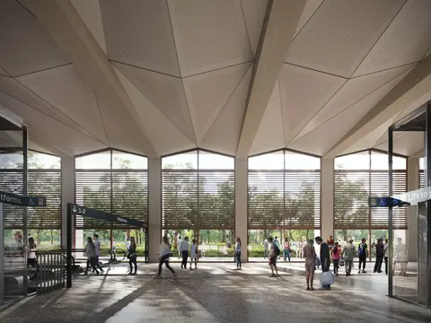

Artist's impression of Bradfield Station
Bradfield Station
Loading map ...
Show me
Explore this page
Main station features
Bradfield Station will become a major transport interchange, providing important connectivity to the future new central business district of the Western Parkland City.
| Feature | Description |
|---|---|
| Centre type | New central business district, known as the Bradfield. |
| Transport connections | Bus (including the new Rapid Bus network), kiss-and-ride bays, temporary park-and-drive, taxi/ride share, walking and cycling. The area will be safeguarded for a future interchange with an East-West Link and Southwest Rail Line extension. |
| Proposed station entry | New street |
| Station type | Cut and cover |
| Provision for integrated station and precinct development | To be determined by the Western Sydney Planning Partnership |
| Local government area | Liverpool City Council |
Location, access and entry
The Bradfield Station will be located east of Badgerys Creek Road, serving the heart of Western Sydney Bradfield City Centre. There will be two entrances – one on the eastern side and another on the western side of the station.
Planning and compliance
The Sydney Metro – Western Sydney Airport project received planning approval from both the Australian and NSW Governments in 2021.
Further information about planning and compliance documentation for the project is available here, and from the websites of our major contractors involved in the project at Bradfield:
- Station Boxes and Tunnelling (SBT) – CPB Contractors and Ghella Joint Venture
- Stations, Systems, Trains, Operations and Maintenance (SSTOM) – Parklife Metro
If you are having difficulty locating a document, please contact the project at sydneymetrowsa@transport.nsw.gov.au or call our 24-hour community information line on 1800 717 703.